Measure the distance or area inside a field
Sentera FieldAgent is able to measure the distance inside a field or measure the area within a field with the Line and Area Measurement tools.
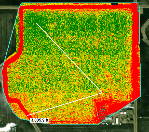
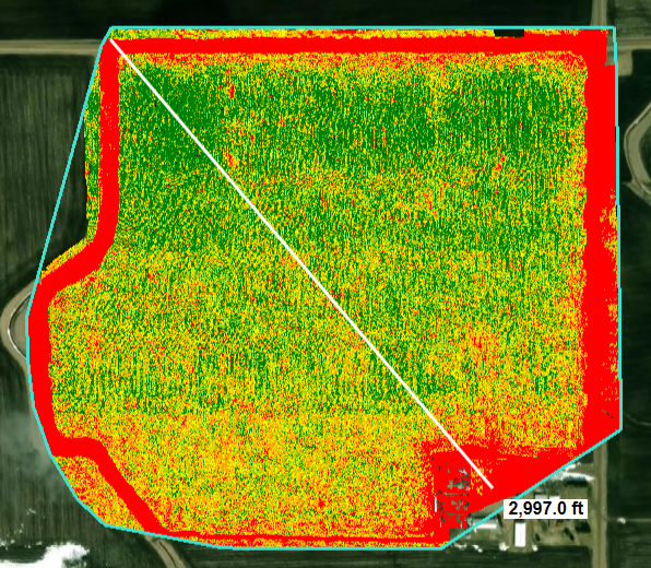
Measure the distance of a field
Navigate to the field by clicking on the field name on the left pane.
Select the Line Measure icon
from the right-hand side of the window.
Left click with your mouse on the map in order to create the first point on the map or area.
If you need to measure another angle, left click with your mouse on the map to create a second point on the map or area.

If needed you can create more points to measure all angles of the field.
View the measurement of that distance that displays. Move the mouse around to see the measurement of the line.

Double left-click with your mouse to exit the Line Measure feature.
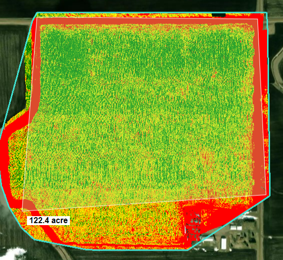
Measure the area of a field
Navigate to the field by clicking on the field name on the left pane.
Select the Area Measure icon
from the right-hand side of the window.
Left click on the first point on the map or area, and then continue adding points until the area is complete.
View the measurement of that area that displays.

Double left-click to exit the Area Measure icon.
To return to normal mouse function
Left click on the Hand icon
on the right hand side.
Here's a video explaining the tools: